Master Plan Recommendations
Trails & Connectivity
Recommendations
RVMD trail network
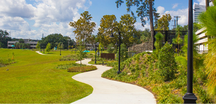
The trails and connectivity provide direct access to nature and promote walking, running, biking and enjoying the outdoors. The community process confirmed that the trails and connectivity are one of the most important amenities of the community. The continuous network provides the most significant central feature of the community, links neighborhoods and reinforces the community’s position at the foothills of the Hogbacks and Rocky Mountains. Survey results and feedback from the community reinforced the importance of the trails and open space network as the heart and ‘main street’ of the community.
In addition to general maintenance and enhancements, the main areas of need identified by the community included:
- Improved regional connections, such as access to Chatfield State Park, Roxborough State Park and the High Line Canal Trail.
- Improve trail network segments and pedestrian crossings in key locations to support walking and biking throughout the community.
- Continued trail improvements to keep the network in good condition and adding new connections in key locations to gain access to community destinations and amenities.
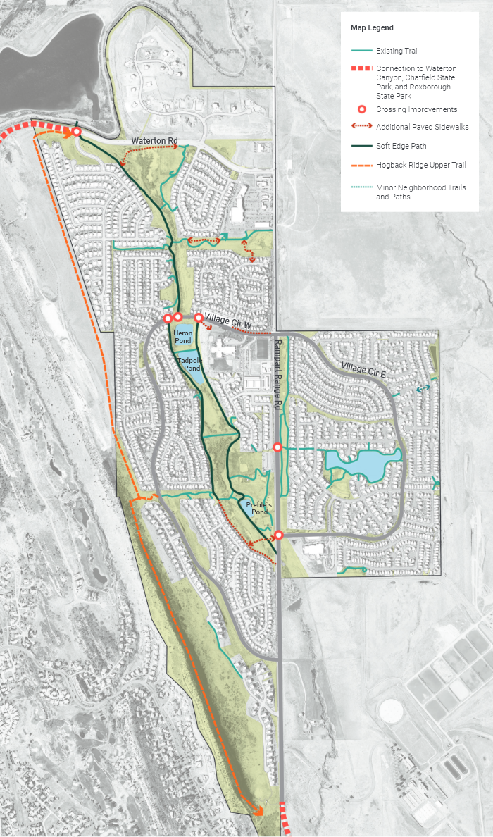
Connections to Waterton Canyon, Chatfield State Park and Roxborough State Park
Although the trail network within the Little Willow Creek open space is well connected and continuous, connections north to regional amenities and trails are lacking. To address this, new multi-use trail connections for bikes and pedestrians should be completed so residents can have safe and easy access to Chatfield State Park, Waterton Canyon and other areas north. Since these improvements are outside the purview of the District, the District should work with Douglas County, the High Line Canal Conservancy and other partners to create a paved multi use path connection to the canal and beyond. Specific trail connections include:
- Waterton Road/High Line Canal Connection - Improve pedestrian crossing by alerting approaching vehicles with clear trail crossing signage, and potential traffic calming elements to slow down traffic.
- New multi-use trail along the south side of Waterton Road between Liverpool Circle and Campfire Street. This trail would provide a new direct connection to the High Line Canal trail for residents living in the northeast neighborhoods of RVMD.
- New multi-use trail connection from the High Line Canal Trail along Waterton Road to Waterton Canyon trailhead and parking area. This critical connection will create a continuous multi-use trail from RVMD to two major amenities located to the north: Waterton Canyon and Chatfield State Park.
- Extending the bike lane or creating a multi-use trail on Rampart Range Rd that connects to Roxborough State Park would provide a continuous network for residents to access the State Park safely. Like connections north, the new trail or bike lane cannot be achieved solely by the District and will require coordination and joint partnering connection with Douglas County or Roxborough State Park or others.
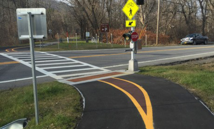
Example of crossing improvement
Improved Pedestrian and Bike Crossings on Major Roads
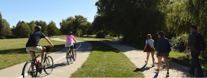
Improving pedestrian and bike crossings on major roads will promote greater use of the trail network and encourage more use by all residents, especially children and youth. The community already has some crossings along Rampart Range Road, Village Circle West and Waterton Road. However, crossing enhancements and new crossings will improve overall connectivity and safety throughout the community.
- New Crossing at Village Circle West and Westside Street – The intersection currently includes ramps on either side of the road but does not have any crossing markers or pedestrian signs. Intersection improvements that add new crossing markings, pedestrian signs and potential pedestrian-activated crossing signal would create better crossing condition for residents connecting to and from the open space trail network.
- New Crossing at Village Circle West and Buckeye Street – The existing intersection only includes ramps on the Buckeye Street side of the road. New intersection improvements that add new crossing markings, pedestrian signs and potential pedestrian-activated crossing signal would create better crossing conditions for residents connecting to and from the open space trail network.
- Improvements to the existing Village Circle West crossing between Westside St. and Buckeye St. – Although the crossing is marked and has signage today, additional improvements including a pedestrian-activated light, or a pedestrian speed table would slow traffic and promote pedestrians continuing on the open space trail. Additionally, bollards or new open space signage announcing Little Willow Creek would provide additional visual cues that indicate the importance of the pedestrian crossing.
- Improvements to existing crossings at N Rampart Range Rd and Village Cir E and Community Park - Current crossings have pedestrian marking and pedestrian-activated signal. However, due to higher speed on Rampart Range Rd, the crossings would benefit with additional pedestrian speed tables to slow traffic down.
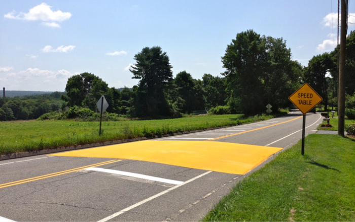
Example of traffic calming element
New and Improved Paths
New and improved paths within the RVMD open space would provide additional connectivity and promote more pedestrian and bicycle use by residents. The new and improved path recommendations are based on field observations and feedback received from the community residents based on their use patterns and knowledge of the trail system.
Additional Paved Sidewalks
Provide additional paved paths in areas where residents have created informal connections to destinations based on frequency of use.
Example of paved sidewalk
- Village Circle West to Roxborough Primary School - Add new sidewalk connection from the south side of the intersection of Village Circle West and the north side of Roxborough Primary School. The sidewalk will replace an existing social path created by children and parents walking to school and encourage more walkability. Due to the connection to the school, the project will need to be coordinated with the Primary School and Douglas County School District. Due to the slope and existing topography, the connection will likely require stairs and an evaluation for ADA compliance.
- Village Circle West between Telluride Place and North Rampart Range Road - Add new sidewalk connection on northside of Village Circle West to provide continuous pedestrian experience. Install attached sidewalk and make sure the new sidewalk aligns with sidewalk on west side of Telluride Place.
- Improved Path Connection from Rampart Range Road to Pine Hills Way – An existing social path exists due to students walking to the Roxborough Intermediate School from neighborhoods on the west side of Little Willow Creek open space. To promote more use and address connectivity to the school, the path should be improved to a permanent soft path or concrete sidewalk. Due to grading and slopes, the path route may need to be adjusted so it can be ADA compliant.
- Roxborough Commons South Open Space – The existing paved trails in the linear open space south of Safeway and the commercial shopping center provide a great connection and amenity for residents wanting to walk to places such as the commercial center. After years of use, social paths have been created by residents indicating the need for additional permanent paths that reinforce resident needs. The area should be evaluated to confirm which paths should be improved as either concrete walkways or stabilized crusher fine paths to provide a stable and reliable path for residents. The following connections should be evaluated and improved:
- Connection from Silvercliff Lane to Existing Sidewalk - The new path will provide a direct connection from the neighborhood south of the commercial center to the open space and areas north. The connection can utilize an existing RVMD open space tract between two homes and connect to the trail in the center of the open space.
- Conversion of Social Paths to Concrete or Crusher Fines – Social paths in the open space that have been created by residents should be evaluated to determine which paths can be converted to a permanently stable surface.
Continuous Soft Edge Path
The main trail network around Little Willow Creek remains in good condition and has been improved over the years to provide a consistent multi use trail for the community. The addition of a continuous soft edge along the main trail that loops around the primary Willow Creek space will enhance the trail system and provide a softer surface for running and walking. The soft path can be added to the edges of the existing concrete trail and run along the main loop around the central open space, so users have the option to walk or exercise on a hard or soft surface.
Example of soft edge path
Hogback Ridge Upper Trail
The Dakota Hogback is the dramatic geologic structure that frames the western edge of the RVMD open space area. As a known upland wildlife corridor with a variety of vegetation types, the area provides an opportunity for residents to access and explore the diverse upland species and native plant communities. The 2006 Master Plan suggested the addition of a formalized soft surface trail, and also the creation of a Habitat Conservation Area paired with trail improvements. The area remains an invaluable natural and ecologic resource today.
Based on community feedback, there is a desire by residents to have expanded options to experience the Dakota Hogback with improved trails and signage. In addition to signage improvements at the main access points, a new soft trail should be added from the access point just south of Jared Way and connecting 1.25 miles north to Waterton Road. Since the area is not fully under the authority of RVMD, a partnership and agreement with the owners of the mining property to the west is needed.
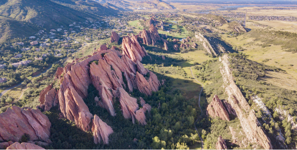
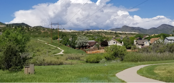
Photo of Dakota Hogback Ridge
Minor Neighborhood Trails and Paths
In addition to the major trail and paths improvements, minor neighborhood connections should be created that provide new short segments of improved paths to replace social trails and dirt paths created by residents over the years. After decades of use by residents, dirt paths and shortcuts have created areas where it is now appropriate to provide permanent paths and trails. These area should be evaluated before improvements are completed to determine the appropriate trail type that provides a stable surface and retains the character of the area, in some cases a soft trail using crusher fines may be appropriate.
Replace Asphalt Trail with Concrete Path
Provide material consistency for trails throughout the open space. Southern trail segments of the community park are currently paved in asphalt and is in poor condition. Replace asphalt trail with concrete to improve trail connectivity.